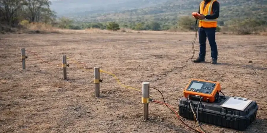
We ran a resistivity line last fall near the Rimrock Mall for a proposed stormwater detention basin, and the data revealed a buried paleochannel at 22 feet that the borings had missed. That’s exactly why VES belongs in the site investigation program. Billings sits on a complex interface of Cretaceous sandstone, alluvial terrace deposits, and shale interbeds—formations that change electrical response sharply over short distances. A calibrated electrical resistivity survey sorts out where the competent rock begins, where lenses of saturated silt hide, and where differential settlement could become a problem. We deploy Wenner and Schlumberger arrays with 84-electrode cables and automatic switching to build 2D sections that the structural engineer can work with directly. For deep utility corridors along the Yellowstone River floodplain, we complement the resistivity lines with a CPT investigation to tie the geoelectric boundaries to cone tip resistance and pore pressure, giving you a continuous profile from grade to refusal.
A 2D resistivity line costs less than two additional borings and gives you a continuous picture of the subsurface that point data alone cannot provide.